Walking round London pt5: Springfield Park to Hackney Wick
From parks to the river, and from flints to an “innovation hub”
(ICYMI: on Sat 5 May, the writer walked 36km as the first instalment of a 120km circumnavigation of the capital for charity. These blogs are to publicise the fundraising and consider the vernacular.)
I’ve lived in London for over 20 years but I’d never heard of Springfield Park. Plenty of people before me have, although perhaps not by that name. Like a letterbox in a new home, the ground keeps providing evidence of previous occupants: flints, a Palaeothic axe, Roman coffins, a late-Saxon longboat.
Presumably named after neither Homer Simpson’s hometown nor Wigan Athletic’s former home ground, Springfield Park was created in 1904 when the combined grounds of three semi-stately homes were purchased by London County Council: flower to the people.
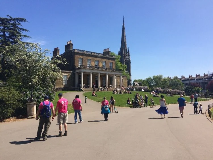
By that time, industrialisation had spread along the same River Lea that had presumably once borne that Saxon longboat. Most of Springfield Park looks down upon the Lea valley, taking advantage of what the management plan boasts is “one of the few hills located within Hackney”. It’s a pleasant enough park, even if the steep downward incline is a little tiring on the calves of walkers who’ve recently passed the 20km mark.

Springfield Marina.
At the bottom of the hill, we leave park and cross the Lea, observing the Springfield Marina — created in 1970 by dredging silt from a meander to offer narrowboat lodgings — before turning a corner literal and metaphorical. It’s a hard right-hand onto the Lea Valley Walk, a 50-miler that doglegs from Luton down to Limehouse. It’s also a welcome 90-degree turn on the larger-scale map: since Clissold Park we’ve been pointing somewhat north-east, not the natural way to aim for the docks, but now we’re arrowing directly south-east, downstream and downhill.
What we don’t know is that we’ve also entered the hard yards. On their own, the next 10 miles or so are fine, as proven by their evident popularity on this gorgeous Saturday. But that creates a long afternoon for walkers who’ve been at it for hours, now obliged to duck and dive through traffic bipedal and bi-pedalled. Thus far the walk has been quietly fascinating, dipping in and out of shade and solitude; from here it will be busy, bright and frequently leg-sapping.

Into the valley of the Lea.
In old money, by crossing the river we’ve gone from Middlesex into Essex (less evocatively, these days we’ve merely swapped Hackney borough for Waltham Forest). We’re also skirting a waterway that caused a long-lasting linguistic divide worthy of Jonathan Swift: is it the Lea or the Lee? While upstream of Hertford it’s mainly called the Lea, thereafter it becomes thrillingly heteronymous. Bureaucracy tends toward the double-e — various Acts of Parliament approved the Lee Navigation and the Lee Valley Regional Park Authority — but Lea is favoured by geographers physical and urban: Leamouth, Lea Bridge, Lea Valley Walk, Lea Valley railway.
Whatever the name, it’s been a working river for thousands of years: gravel and mineral extraction, grain transportation, reservoirs, industry, goods. Further upstream and away from contamination, it’s a key source of H2O for London’s thirsty gullet, having been tapped after the New River we walked along an hour ago proved somewhat insufficient for the expanding population.
As is often the way, such fluvial fiddling can leave a river needing a little support in its old age. By this point the Lea is almost nine-tenths of the way through its 50-mile course and it’s starting to meander a bit — hence Walthamstow Marshes, Leyton Marshes, Hackney Marshes.
Such semi-uninhabitable land makes the valley feel much wider than the river deserves; although the electricity pylons striding southwards confidently are only 500m to our left, they seem a prairie away. They certainly must have seemed so to Alliott Verdon Roe, who in 1909 clambered aboard his tri-plane — built under the Lea Valley Lines railway arches we’ve just passed through — and piloted it a historic, triumphant, terrifying and presumably eventually soggy 900 feet across Walthamstow Marshes. A plaque upon the railway bridge commemorates the achievement, if remaining suitably less forthcoming about Verdon Roe’s subsequent enthusiasm for Oswald Mosley and the British Union of Fascists.
As if offended by the lexicographical inconsistency of the Lee Valley Ice Centre being on Lea Bridge Road, the path turns abruptly right to cross the river again. Skirting Millfields Park before ducking under Lea Bridge Road, it pops out to see the waterway bifurcate. While the river itself flows off east, the Lee Navigation points off purposefully southerly, followed by us, the path and a curious floating contraption.
Puttering along at roughly walking pace, a diesel-powered barge is pushing another boat, lashed to its front like a somewhat unwilling figurehead. The whole is helmed by a brawny youth clearly not unused to the ways of the water, although his lobster-pink skin suggests he might have forgotten the sun cream. He’s sharing a can and a chat with his two passengers, of similar age if not of experience: he has to warn them worryingly late to duck, seconds before they’re slowly decapitated by the cobbled footbridge which the path, with us upon it, now takes back over to the eastern flank.
We’re following the Hackney Cut — yeah, you heard right — which dates from 1769, but humans have been endeavouring to make the Lea more navigable for almost a thousand years. The Abbot of Waltham had a go in 1190, and in 1425, a Lea scheme prompted the first Act of Parliament granted for navigational improvement. Wisely, a follow-up five years later introduced a financial imperative by allowing landowners to levy tolls if they’d been dredging.
Now the wide vista has gone: we’re hemmed in by the Middlesex Filter Beds, which — in concord with the Essex Filter Beds across the Lea — from 1852 to 1969 provided east Londoners with just the 42 million gallons of water per day. Abandoned by progress and returned to nature, they’ve been a wildlife reserve since 1988, the foliage gradually covering the ornate Victorian brickwork.
Inverting the 500-year-old saw about children, footballers are audible but invisible on the nearby Hackney Marshes’ eighty-odd pitches. By the time we reach Marshgate Bridge, where the flats on the west of the cut are growing to a dozen floors and more, we’re engaged in our own nimble footwork: a towpath barely five feet wide is being shared by walkers and cyclists heading in both directions.

Street life, if the street’s a bit wet.
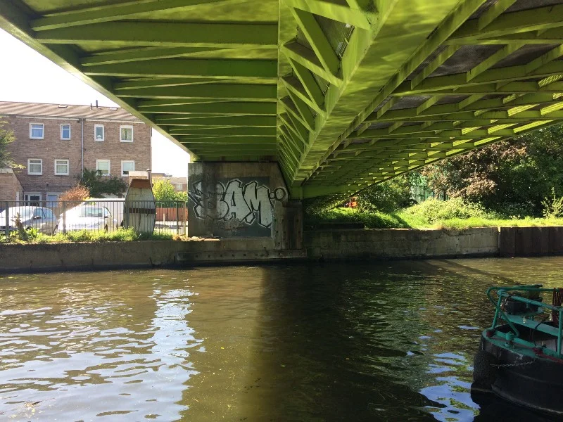
We’re now sandwiched between Homerton in the west and Hackney Wick in the east, and things have become understandably hipster: beards, beanies, barges and banging music. Many of those living on the water are actively engaged in enhancing their habitat — there’s a surprising amount of Black and Decker going on — while simultaneously enjoying tunes in the searing sun. It’s good to see so much life on a waterway, even if it could do with a tidy-up troop to match the neighbourhood-watch Towpath Patrol.
Those of us who are even more transient have just passed the 25km mark under the A12 when we reach the third and final checkpoint at Here East — apparently “home to established names and nimble startups alike. Radicals, reformers, visionaries, industry heroes and like-minded locals — they’re all part of our East London heritage and its geography of innovation.”
Chewing on our energy bars and fruit mixes, accepting the good wishes of volunteers and passers-by, we pause briefly, gird our loins and push on. If there’s three checkpoints, we’re three-quarters of the way there, right? Time to take a last lap of fascinating docklands. Or so I thought…
Coming up next: The regeneration game
The Mencap Capital Challenge is a charity walk circling London in four quarters, each roughly 30km. You can donate or sponsor the writer at justgiving.com/garyparkinson1974. You can also join in: the East quarter (Royal Albert Docks to Crystal Palace) will take place on Sat 26 May, the South quarter (Crystal Palace to Richmond) on Sat 9 June, the West quarter (Richmond to Hendon) on Sat 7 July.
NORTHERN QUARTER, SAT 5 MAY 2018
• Pt1: Wembley to East Finchley • Pt2: …to Finsbury Park
• Pt3: …to Clissold Park • Pt4: …to Springfield Park
• Pt5: …to Hackney Wick • Pt6: …to Bow Back River
• Pt7: …to Channelsea River • Pt8: …to Royal Victoria Dock
EASTERN QUARTER, SAT 26 MAY 2018
• Pt9: Victoria Dock to North Woolwich Pier • Pt10: …to Maryon Park
• Pt11: …to Hornfair Park • Pt12: …to Oxleas Wood
• Pt13: …to Eltham Palace • Pt14: …to Grove Park
• Pt15: …to Beckenham Place Park • Pt16: …to Penge
• Pt17: …to Crystal Palace Park • Pt18: …to Upper Norwood
SOUTHERN QUARTER, SAT 9 JUN 2018
• Pt19: Crystal Palace to Beulah Hill • Pt20: …to Streatham Common
• Pt21: …to Tooting Bec • Pt22: …to Wandsworth Common
• Pt23: …to Wimbledon Park • Pt24: …to Richmond Bridge
WESTERN QUARTER, SAT 7 JUL 2018
• Pt25: Richmond Bridge to Isleworth • Pt26: …to Hanwell Locks
• Pt27: …to Horsenden Hill • Pt28: …to Sudbury Hill
• Pt29: …to Wembley, and that's that